Articles in this section
- How to Uniquely Identify Hotlink Module Zones in Archicad Schedules?
- How to Set the Origin of a 3D Texture in Archicad?
- Why Do Drawings Exported to PDF in Archicad Generate Very Large Files?
- How to Map a Custom Archicad Property to an IFC Property?
- How to Remove an Archicad Educational Licence from a Computer?
- How to Change an Archicad File Started in the International Version to the Spanish Version?
- How to Import a PDF to Use as a Reference in Archicad?
- How to Use Educational and Commercial Versions of Archicad on the Same Computer?
- How to Get the Archicad Connection with Twinmotion?
- How to Create a Structural Frame with the Create Truss Tool in Archicad?
How to Export an Archicad Model to Google Earth (.KMZ)?
Archicad lets you export 3D models to Google Earth using the .KMZ format, making it easier to visualise the project in its real geographic context. This article explains the available methods, the altitude options and the known limitations of the process.
Method 1 - Send the model directly to Google Earth
This method exports the model as a .kmz file and opens it automatically in Google Earth in a single step.
- Go to File → Interoperability → Send Model to Google Earth.
- In the Google Earth Export Options dialog box, select the altitude setting you want:
- Absolute Altitude: places the model at the altitude defined in Archicad, above sea level.
-
Draped over Terrain: automatically fits the model to Google Earth's terrain.
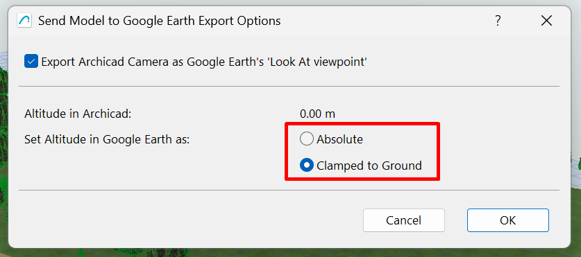
- Click OK to continue with the export.
- Archicad generates the .kmz file and opens Google Earth automatically.
Note: To use this method you need Google Earth 4 or a later version correctly installed on your computer. The altitude option you select directly affects the model's vertical position.
Method 2 - Save the model as a .KMZ file
This method gives you more control over the export options and is the most recommended way to share the file or review its content before exporting it.
- Open the 3D Window.
- Go to File → Save As.
-
Select the Google Earth (*.kmz) format.
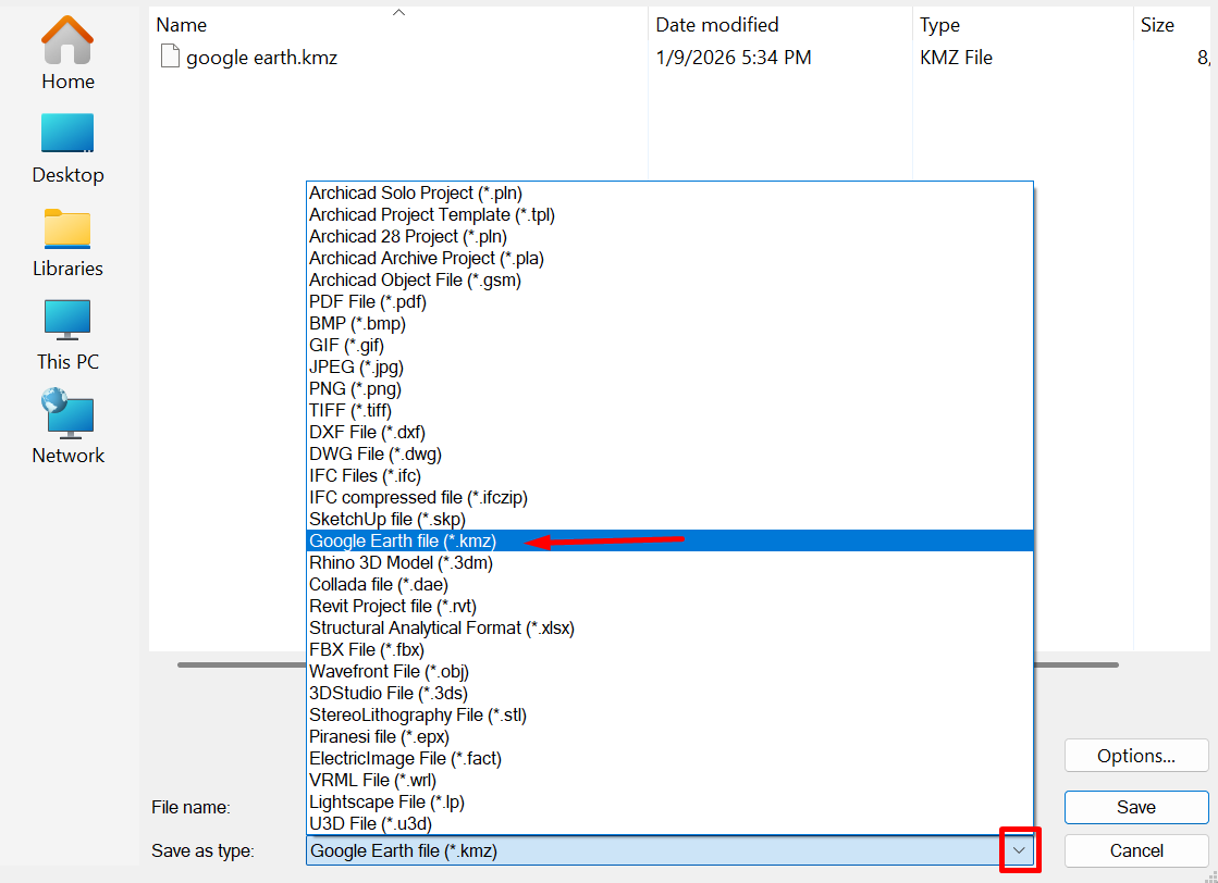
- Click Save.
- A new window will appear where you can select the elements of the model you want to export to Google Earth.
-
Check or uncheck elements as needed and click OK to continue with the export.
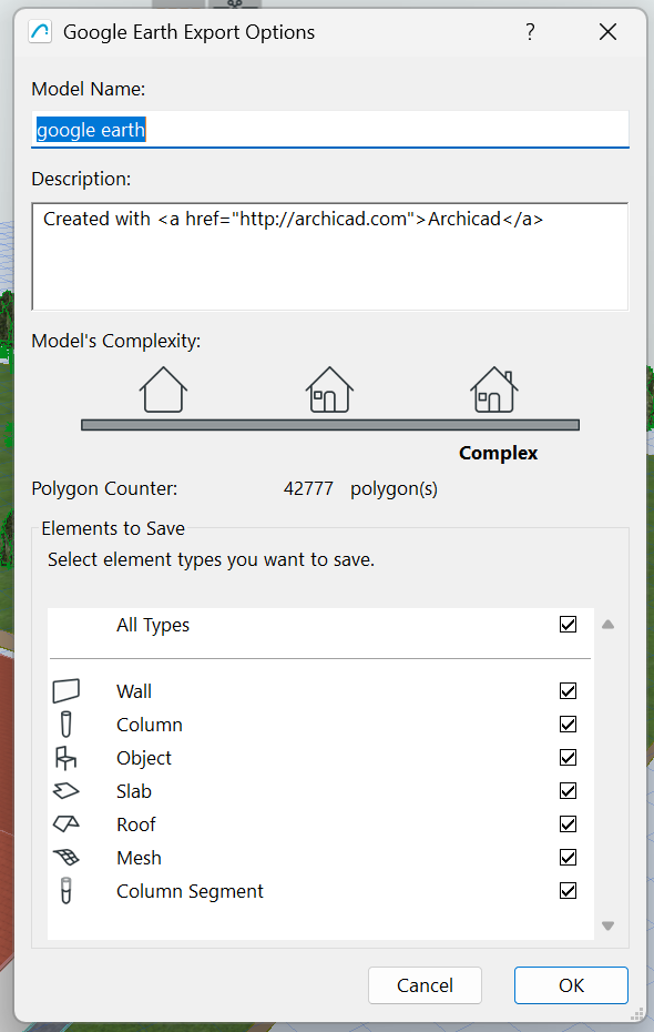
Note: This selection lets you limit the export to only the relevant elements, reducing the file size.
KMZ export options
- Export the active camera as a Point of View, to define the initial view in Google Earth.
-
Set altitude as:
- Absolute Altitude (above sea level): places the model at the exact altitude defined in Archicad.
- Draped over Terrain: places the model directly on Google Earth's terrain.
Note: If the model appears too high or too low in Google Earth, check the option selected under Set altitude as.
Google Earth limitations
- Some .kmz files may contain triangular faces with very small angles that Google Earth does not import correctly.
- If the 3D camera in Archicad is positioned below terrain level, the resulting view in Google Earth will not match the original view.
Recommendations
- Always check the Project Location before exporting.
- Make sure the 3D camera is positioned above the terrain.
- Try both altitude options if the positioning is not correct.
Related articles
- How to Uniquely Identify Hotlink Module Zones in Archicad Schedules?
- How to Set the Origin of a 3D Texture in Archicad?
- Why Do Drawings Exported to PDF in Archicad Generate Very Large Files?
- How to Map a Custom Archicad Property to an IFC Property?
- How to Remove an Archicad Educational Licence from a Computer?